Land-use classification for soil monitoring
Land-use classification for state of the environment soil quality monitoring and reporting
Regional authorities and the Land Monitoring Forum (LMF) have been monitoring soil quality (including trace elements) since the Landcare Research ‘500 Soils’ programme finished in 2000. A subsequent review by Hill et al. (2003) resulted in improvements and the publication of the soil quality guidelines in 2009 (Hill and Sparling (2009).
The programme was initially designed to give regions flexibility in reporting on soil quality issues most relevant to their region however the Environmental Reporting Act 2015 requires a more uniform approach for national-level reporting.
Land use is recognised as a critical driver of environmental change, and regional council SOE soil quality monitoring underpins national reporting on land use. There are however, some inconsistencies in land-use classification which occur both between councils and over time.
Greater consistency in land-use categorisation was recognised as a high priority to inform improvements in soil quality monitoring at the LMF meeting in March 2021, and it was a recommendation for further work stemming from the development of the Soil Quality & Trace Element Monitoring NEMS by the National Environmental Monitoring Standards (NEMS) Steering Group. This project also fits within the Environmental Monitoring and Reporting land project for improving regional and national reporting of soil quality and trace element data (via the Land, Air, Water Aotearoa website and national Environmental Domain reports), which is supported by all 16 regional authorities.
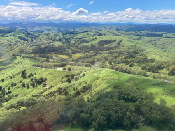
Landscape diversity in Gisborne District (GDC)
Gisborne District Council (GDC) has just commenced its soil quality monitoring programme and this work has assisted with the development of the programme, as well as meeting national objectives outlined above. The medium advice grant project was undertaken for GDC under Envirolink grant 2222-GSDC170.
The objectives of the work were:
- To develop clearly defined land-use categories that enable consistent classification, regionally and nationally, for SOE soil quality monitoring and reporting;
- To scope a tool to provide different contextual views on land-use data (including historical) and link alternative land-use classification systems.
GDC Environmental Scientist David Sluter says “the work promoted useful collaboration between LMF members to discuss how we classify land use and identify what was required to be consistent”. David explains that the work has fed into the development of an Envirolink Tools project to assist in consistent implementation of land use classifications at a national scale. He says “this work has come at a time when GDC is beginning monitoring and therefore needing to classify land use in our region so it has provided a great starting platform for us to build on”.
To read the full report click on the link below:
Last modified: